Why Every Map Tells a Historical Story Waiting to Be Discovered
Explore how maps reveal captivating historical narratives and insights about our world.
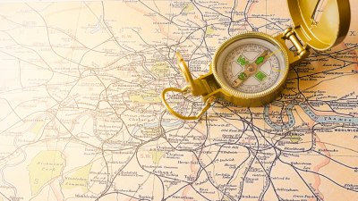
Maps are more than just navigational tools; they are historical documents that tell stories of exploration, conflict, trade, and culture. Since ancient times, maps have recorded human experiences, representing not only the geographic locations but also the relationships between peoples and their environments. Each map we encounter serves as a window into the past, providing insights into societal values, technological advancements, and historical events that shaped the world as we know it today.
Maps as Historical Records
Throughout history, maps have functioned as crucial records of territory and governance. The earliest known maps date back to ancient Babylonia, where clay tablets depicted the surrounding regions. These early examples were rudimentary but served to inform rulers and citizens about land ownership and resource allocation.
The ancient Greeks contributed significantly to cartography, with figures like Eratosthenes calculating the Earth's circumference and creating a map based on his calculations. Their work laid the foundation for understanding the world’s geography, and many of their maps and concepts have influenced cartography throughout the centuries.
The Power of Perspective
Each map reflects the worldview of its creator, offering insights into the societal values and priorities of the time. For example, medieval European maps often placed Jerusalem at the center, reflecting the importance of religion during that period. In contrast, modern maps are typically oriented with north at the top, a convention influenced by Western perspectives.
This geographical bias can lead to significant misunderstandings about global politics and history. Maps created during colonial expansion often exaggerated territories of colonial powers, leading to skewed perceptions of national significance and control over land—something critically examined in post-colonial studies.
Mapping the Colonization of New Lands
The Age of Exploration brought about a surge in map-making, as European powers sought to document newly discovered lands. Maps from this era not only portrayed new territories but also included notes on indigenous populations, resources, and potential trade routes. These documents can reveal attitudes towards colonization, with many maps illustrating a paternalistic view of non-European cultures.
For example, the famous map created by Martin Waldseemüller in 1507 was one of the first to use the name 'America.' This map not only redefined global geography but also marked the beginning of the European conception of the New World. Such maps often ignored the existence and history of indigenous peoples, emphasizing the explorers' narratives rather than a holistic understanding of the land.
Technological Advances in Mapping
The evolution of technology has dramatically transformed the process of map-making. From the invention of the printing press to modern Geographic Information Systems (GIS), each technological advancement has expanded our ability to create more accurate and detailed maps. The advent of satellite imagery in the late 20th century revolutionized mapping, allowing for the production of high-resolution maps based on real-time data.
Moreover, these technology-driven maps are not just tools for navigation; they tell complex stories about environmental changes, urban growth, and social dynamics. Climate change is illustrated through topographic maps that display rising sea levels and shrinking glaciers, providing a historical context to today's environmental crises. Digital platforms allow for the layering of different data sets, enabling a deeper analysis of how changes impact communities.
Maps and Cultural Identity
Maps are inherently tied to cultural identity. They reflect and shape how communities perceive their place in the world. In some cases, indigenous peoples create their maps that are informed by their relationships with the land, often depicting spiritual significance that might not translate into Western mapping conventions.
For instance, Native American maps often highlight sacred sites, traditional territories, and resource-rich areas. These maps demonstrate an understanding of the environment that is often absent in Western representations. The resurgence of indigenous mapping initiatives emphasizes the importance of these narratives in preserving culture and history against the backdrop of colonial histories.
Stories of Conflict and Peace
Maps have also played a crucial role in exposing stories of conflict and resolution. Historical maps often delineate borders established by treaties, wars, and negotiations, providing insights into the geopolitical landscape. The peace treaties following the World Wars have created lasting impacts on national boundaries, and the maps of those agreements tell tales of diplomacy and discord.
Maps such as those depicting Europe post-World War I (Treaty of Versailles) illustrate the redrawing of borders and the establishment of new nations, fundamentally altering ethnic and national identities. Regions formerly under one political control were split, resulting in significant historical implications that resonate today.
The Cartographer's Influence
The role of the cartographer can shape the historical narratives that maps convey. A map is often a subjective portrayal of reality, influenced by the cartographer's intentions, biases, and cultural background. Understanding this influence is essential to critically evaluating maps as historical documents.
Throughout history, notable cartographers have imbued their maps with personal narratives, revealing geographical knowledge unique to their circumstances. For example, Samuel de Champlain, known as the “Father of New France,” created maps that documented and celebrated exploration in North America, framing these lands through a lens of European discovery.
The Future of Mapping
As we look to the future, the field of cartography continues to evolve. Advances in technology and the increasing availability of data empower individuals and communities to engage in the mapping process. Crowd-sourced maps, such as those used in humanitarian crises, highlight a collective understanding of geography driven by people’s lived experiences rather than solely by institutional authorities.
Furthermore, the rise of virtual and augmented reality opens exciting new avenues for experiencing maps. Interactive mapping allows users to explore historical events, traverse locations geographically and temporally, and gain a deeper understanding of complex historical narratives.
Discovering History Through Maps
Every map is a story waiting to be explored, presenting a historical narrative framed by the context of its creation. From ancient Babylonian tablets to contemporary digital representations, maps serve as crucial artifacts that illustrate humanity’s interaction with the world. As we engage with these documents, it is vital to approach them with a critical eye, understanding the biases and perspectives inherent within them. Ultimately, maps are vital tools for uncovering the multifaceted dimensions of history, heritage, and identity, connecting us to both our past and future.